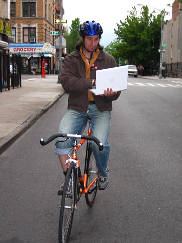
Bronx commute
So I thought about doing a monthly or maybe weekly report on a bridge or a commute route. The idea is to give information to fellow commuting cyclists and focus on areas of the city that people may think are impossible or difficult to get to by bicycle.
Hopefully people can report on my information or maybe let me know about bridges and roadways they experience on the daily.
One thing that is very handy is D.O.T. 2004 New York City Bike map. This is a free map of the 5 boroughs put out by the city and can be picked up at local bike shops or by calling 311. Its a big colorful map which caters to bikes showing what are ideal routes, streets with bike lanes and those areas that have a functioning greenway. I showed my map to a car owner and he wanted one, just for its clear directions and layout.
I always refer to this map before venturing out into unknown territory.
The map is updated often but it still can be unclear what kind of road conditions you may encounter. Often greenways can be close to unspecific construction or you may not be able to tell which side of a bridge you are supposed to be on. This is what inspired me to share my information about my most recent commute.
I live in Williamsburg Brooklyn and have been taking an intro level gardening course at the Bronx botanical Gardens. This is a far trek and this was the first time I'd ventured it by bike. I set off through Greenpoint, down McGuiness Ave. towards the Pulaski Bridge. This is a short drawbridge that connects Brooklyn to Long Island City Queens and takes you across the Newtown creek. There is a fairly wide bike path on the West side of the bridge. Some brave riders take the car path but its not recommended. I took it a few nights ago and for the first time in 15 years of riding in NYC, the bridge was up. Must have been a toxic waste barge that was piled too high.
So this time I took the bike path and got off in LIC. Then I took Vernon Blvd all the way towards the top of Queens in Astoria. This is the best route to travel if you are going directly to the Tribourough Bridge. Basically you are traveling along the East River on a wide 2 way street with less traffic. Around the Noguchi Museum and Socrates Sculpture Garden I made a right onto Broadway and headed to 21st. Street. This is the major 2 way street that cuts through Queens North and South. You can take this all the way from exiting the Pulaski if you like a super crowded street with livery cabs speeding to car washes and cube trucks trying to run you off the road. I prefer the more scenic Vernon and is the recommended path in the bike map. The bike map also recommends using 36th St.
The next destination was the pedestrian entrance to the Triborough. This is the major monstrosity that looms ahead of you heading north. It is a major roadway that connects Queens with Manhattan and the Bronx and passes over Randalls Island. There are two functioning bike paths on the North and South side of the Triborough, They may appear to be closed but aren't. I have never seen another biker on this bridge but than again I've only ridden it twice. The entrance to the bike path is a set of stairs on Hoyt Ave and 27th st. but it will feel like you are going to Astoria Blvd. Once you get in this area just note it is on the North side of the freeway entrance and is a set of stairs, kind of hidden. I'm also not sure if you are supposed to take the North side for Bronx bound and vise versa for Queens bound. I'm not sure there is any rule but the bike path is kind of narrow and the bike map seems to imply to take the North bound side to Randalls.
So after a couple of stairs you head across the bridge and then have to dismount in a few places so heads up. At one point in the middle of the path are some orange plastic trash fencing. No its not the police trying to stop critical mass. Just be aware the path narrows and you have to make a few short hair pin turns. After 2 sets of short stairs down you take the long curving down ramp towards Randal's island. At the end of this long down sloping pathway is ramp with a 90 degree turn and another ramp which can be murder on a brakeless fixed gear so take it slow. You get off in the middle of Randall's Island and to proceed to the Bronx you need to head north or Left. Basically you are getting off one bike path on the side of a bridge and hoping right back on another, which is just a continuation of the Triborough into the Bronx. So go across the one way traffic road to the roadway going left and follow it to you see another bridge expansion and another concrete ramp heading up. They were doing construction on it so it looked like some sort of lesser known Christo project all wrapped in plastic. I think they were painting the bridge like those endless projects on the Williamsburg bridge that never seem to be finished...ah just how painted does a bridge need to be? This next section is rather short. Wave to the construction workers in the tyvek suits, they're friendly and surprised to see pedestrians actually using these pathways. On the downside you will run into so steps so keep your head up unless you've got a dual suspension mountain bike and are into that sort of thing.
You get off in the Bronx in the middle of a twisted gnarl of overhead passes and semi trucks. This is basically the Triborough turning into the Bruckner expressway. Follow the monstrosity of concrete and diesel fumes until you get to E 132nd street. Make a left under the overpass. The hard part is over. There are many streets in the BX wide and accessible for bikes. The Bike map recommends St. Ann’s, E 149th and Prospect Ave. To get to the Bronx Botanical Gardens I took Prospect Ave which turned into Crotona Ave. It was wide and even had a bike lane for a good portion of it.
On the way back I headed into Manhattan. I took Willis Ave and the Willis Ave Bridge. The bike map says to walk your bike but I saw a few riders going along the path with ease. Pedestrians seemed friendly and even moved out of the way for bikes with little or no hassle.


1 Comments:
I live in Astoria and am pretty familiar with the streets there. Vernon can have some speedy traffic on it. 36th (and 35th I think in the other direction) both have bike lanes. Not bad, but the streets aren't too wide and you have a lot of cars in the bike lanes. 23rd street heads north towards the Triborough bridge and doesn't have much traffic. I use it a lot.
Post a Comment
<< Home